Showers and thunderstorms are expected to develop across the tri-state area later Friday, potentially bringing torrential rain and gusty winds.
Right now, it appears that the greatest risk for potentially severe weather is well north and west of New York City, but pop-up storms are possible across the tri-state as a front approaches.

Watch NBC 4 free wherever you are
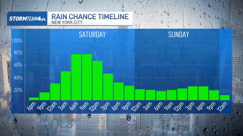
Showers and storms are possible again Saturday as the front slowly moves through, mainly during the afternoon and evening hours. This storm system is expected to have a greater impact on the immediate New York City area as it moves out. No widespread severe weather is expected, but rain could be heavy at times.
Isolated flash flooding is a potential risk.
Get Tri-state area news delivered to your inbox with NBC New York's News Headlines newsletter.

Sunday will be mainly dry early, which is great for New York City's Puerto Rican Day Parade, before another system moves in later in the day. It should be a nice afternoon for the parade, still.


Track any approaching rain using our interactive radar below.